
To learn anything, the only qualification is “zeal to know”. Some people will have much practical knowledge even though they have fewer marks or grades. And they are the ones who become successful in their careers. It is because they are interested in knowing more than securing marks.
They always ask questions like, what? why? and how?
If you also start asking these questions, then sure you will also acquire good general knowledge.
Some people live far away from their home town and look for a holiday to take some train and reach home. Of all transportations, the one mechanism which everyone like is going by train.
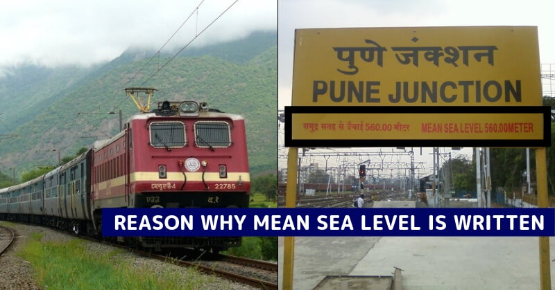
However, if you are the one who likes to learn everything around you, you might have already observed many things in a railway station. Next time when you go to any railway station in India, instead of observing girls around you, go to the far end of the platform on either of the two directions. You will see a board made of stone that mentions the name of the station in English, Hindi and the local language of the state where the station is located.
Another observation you need to see is, the board faces the railway track so that passengers and the train driver can read it easily.
However, besides the name of the station, the board also has an additional detail called MSL.
Well, how many of you observed this?
Did you try to know what it is?
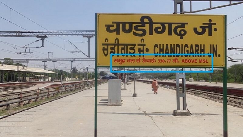
The abbreviation of MSL is Mean Sea Level. The common standard of measurement of the height of land from a level that is considered uniformly equal around the earth is Elevation from the Sea Level. Simply to say, the mean sea level indicates the height of the location with reference to the sea level.
As the measurement of the height of land is done keeping sea level as a base, every major city, township, hill station, mountain, pass, or other sites of geographic or topographic importance have their own height from the sea level.
So when you read in books that the height of the Mount Everest is 8,848 meters, you are being given the height from the sea level.
It means that travelers and mountain climbers can benefit from this information. Civil engineers use this concept of MSL for the construction of all structures including buildings.
How Does It Help Railway Drivers?
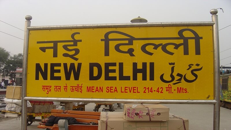
indian trains cover long distances across varied geographic landscapes and terrain that might not be the same at any two consecutive points. For example, a train traveling from New Delhi to Shimla moves from 225 meters above mean sea level to 2,206 meters above means sea level.
With the help of the mean sea level, the train driver and the guard can measure the gradient or slope between two stations. This helps the driver and the train engineers to calculate the speed to be maintained between the stations. For example, when moving to a lower elevation, the train will have to factor in the slope and braking. The elevation is also mentioned on railway bridges.
However, today these are not needed due to the advent of technology. The speed of a train between two stations is now set as per a plan that takes into account traffic on a given line, distance, weather, time of the day as well as elevation.
But, isn’t it exciting to learn a new thing? What do you say? Did you observe anything informative like this in a railway station? If so, share us in the comments. We are sure many of us have traveled in trains. Check out these luxury trains in which you should visit at least once. Have you experienced the same? Let us know in the comments below.
Entertales is on YouTube, Click here to subscribe for latest videos and updates.


